|
|
Resource Type:
|
Photographs
|
|
Language:
|
English
|
|
Location:
|
RP0067D--ROLLED PHOTO
41/1/7
P33984
|
|
Date:
|
190812
|
|
Author/Creator:
|
Geographia Ltd.
|
|
Title:
|
Map of Southwest China (Tibet and Yunnan Provinces) $c / compiled by H. R. Davies. [RP0067D]
|
|
Publisher:
|
S.l. : Geographia Ltd., December 1908.
|
|
Format:
|
color
12x16.5
None
|
|
Description:
|
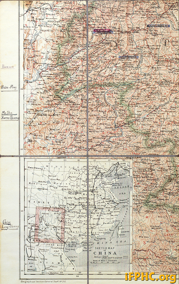
Description: Map of Southwest China, Part D=21-25 latitude; 97-99 longitude (West Yunnan Province).
Map of Southwest China in 6 parts (A-F). Covers latitude 21-30 N. of equator; longitude 97-106 E. of Greenwich). Includes notations for mission stations for various religious groups. A=26-30 latitude; 97-99 longitude (map of Southwest Tibet). -- B=26-30 latitude; 100-103 longitude (map of S. Central Tibet). -- C=26-30 latitude; 104-106 longitude (map of Southeast Tibet). -- D=21-25 latitude; 97-99 longitude (West Yunnan Province). -- E=21-25 latitude; 100-103 longitude (Central Yunnan Province). -- F=21-25 latitude; 104-106 longitude (Eastern Yunnan Province).
|
|
Subject:
|
Tibet--Maps.
|
|
Contributor(s):
|
China--Yunnan Province--Maps.
|
|
Date Cataloged:
|
06/21/2021
|
| Archive ID | Delivery Description | Price | ||
| 149194 | Research Room Request | * See note below |

|
Add to cart. |
* If you would like a high-resolution image and/or a license to republish this photograph, please send an email to [email protected] with your request. Your request should state the Photograph ID number of each requested image (the Photograph ID number starts with "P") and your purpose for requesting the image. A staff member will contact you within three working days. Images may be subject to copyright and may not be available.
Click Here for Terms and Conditions
Return to search